
The last few days have been rough, sort of a three steps forward, two steps back sort of deal. We had four huge climbs (4,800m- 4,900m each) to do, and in between, there were little ups and downs which made it all the more difficult. The tops of the passes were often steep, and coupled with the poor road conditions, this left us pushing instead of pedaling most of the way up. Once we got to the downhill, instead of feeling excited or relieved, we sort of just felt dread as the road was in such bad condition we hardly ever surpassed 10-15km/h (on a downhill!). Plus, we knew once we got down that we would just have to begin the next climb right away. That being said, it was absolutely beautiful and though it was tough, every calorie burned was more than worth it to be high in the Bolivian mountains.

A pass we just descended now far in the distance.

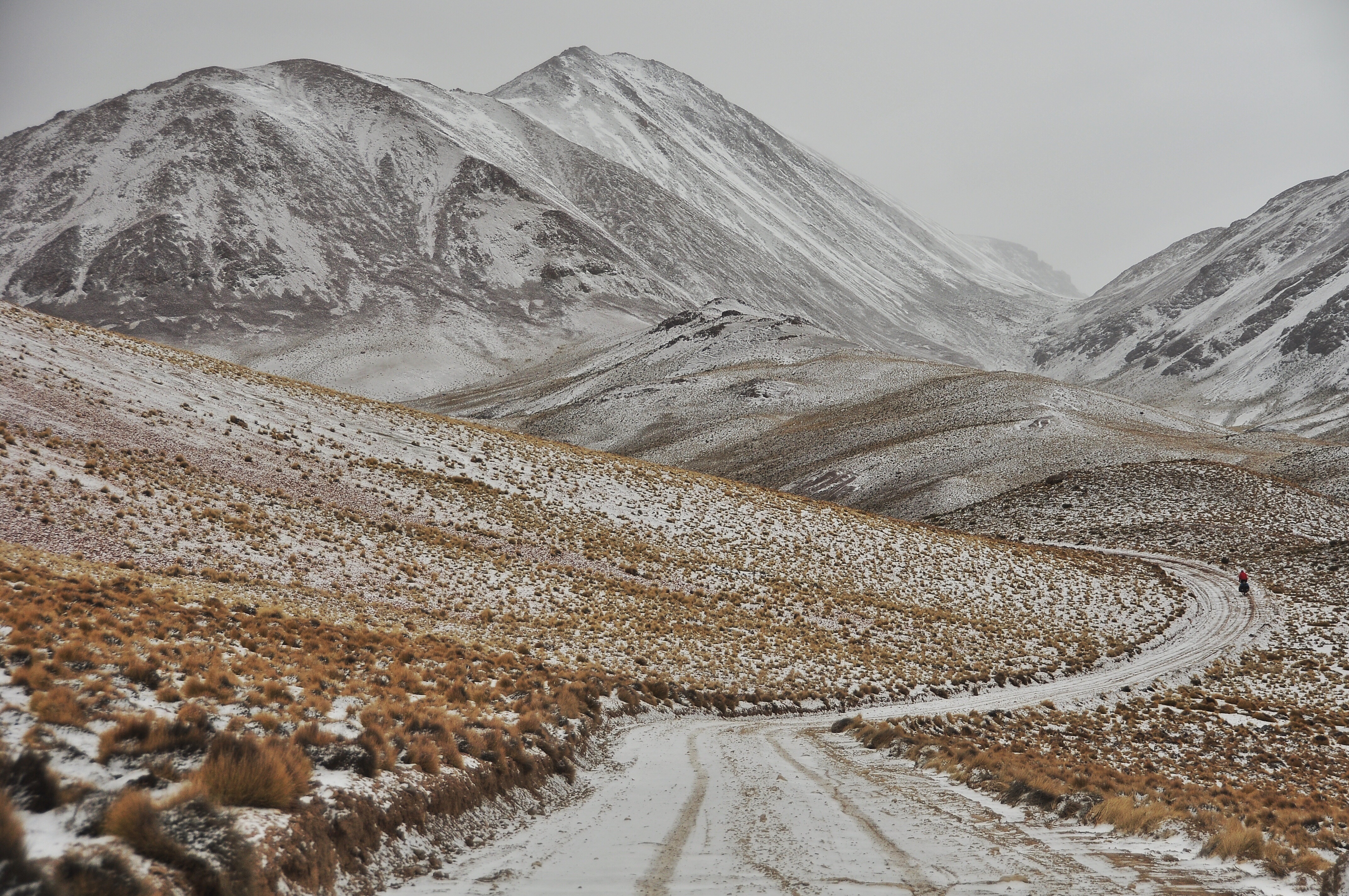
This is what makes all the hard climbs worth it!!

One of many river crossings, most of which were half frozen which left our feet very cold!

Llamas llamas everywhere!


One of the partially frozen streams melting in the sun.

One of the many lakes throughout the region. They all gave salt crusted along the edge so we couldn’t drink from them but there were no shortage of small streams around so it wasn’t a problem.

Kevin pushing.

Enjoying the view ahead.


Beautiful camping!


Kevin getting ready to cross a small stream.


Headed into a storm!
And then it snowed. As we still had two passes to go (4,800m+ each) we were worried about a storm rolling in and trapping us for days, but thankfully it didn’t snow very hard and by the time we climbed up and over the first pass we were out of the clouds.

Kevin crossing a half frozen stream barefoot as its snowing. Miserable!

Pushing, we did a lot of pushing.
 .
.


Contemplating the ride.

About an hour into our day we saw this local motorcyclist who we stopped to ask about the weather. He told us we were all clear on the other side, whereas he was headed right into the storm!

This older lady jumped off the back off the motorcycle in order to cross the stream barefoot like us.


After climbing out of the snow, we came to a whole city of ruins 4,700m up a windy and unprotected hillside. We couldn’t figure out why the village had been so large (hundreds of huge houses), crowded, or why it had been in that location until we found out that it was an old Spanish colony from the 1600s, which made a lot more sense. It was neat to climb inside the ruined houses, and we ended up eating lunch in one. None of my photos turned out since my lens was dirty, so you will really just have to imagine this huge crumbled city on your own.

Pikes on Bikes technical details for this route: This blog entry took place along the purple route, between the towns of Quentena and San Pablo.

For a photo of the day and other updates follow me on facebook here, and for some awkwardly cropped photos from our journey, follow us on Instagram @awanderingphoto!

Epic! Regards Thom.
WOW! Incredible experience! I bet you hear this a lot. 😉
Whoa! This sounds like such a cool but hard experience. I’m definitely loving reading these posts
Incredible, thanks for sharing with us!
Pingback: Cycling Through Bolivia: A Photographic Journey | The Wandering Nomads
Pingback: Favorite Cycling Routes: Extended Lagunas Route (Bolivian Altiplano) | The Wandering Nomads